The ESS Asphalt Pavement Scanner is a groundbreaking system that provides detailed maps for Q/A and Q/C inspections of new asphalt construction.
The Asphalt Pavement Scanner performs continuous surveys from a push cart, vehicle, or roller compactor.
The system has been designed to dovetail into existing workflows during construction and inspection.
The scanner provides real-time maps of compaction, density, and temperature. Additionally, the system also measures roughness and thickness.
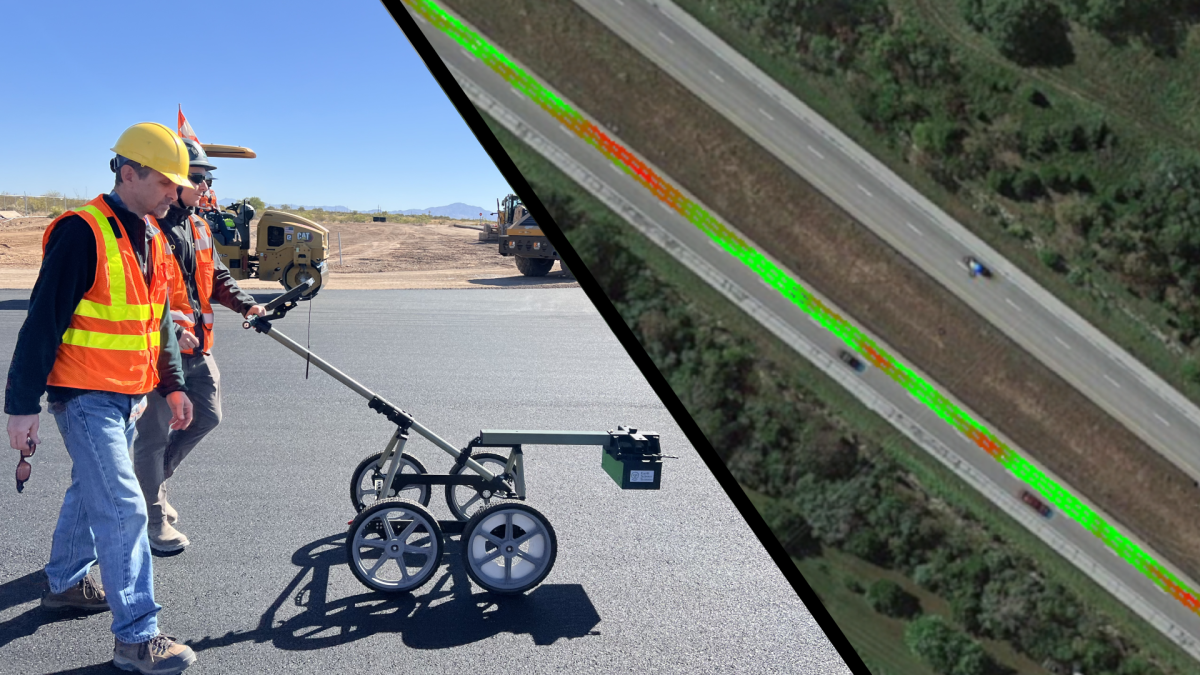
Maps of dielectric, compaction, temperature, and pass count provide a measure of uniformity–
that cannot be obtained from spot measurements using traditional density gauges. These maps in turn enable better Q/A and Q/C, and ultimately reduced risk and cost.
The Asphalt Pavement Scanner measures the pavement’s dielectric constant using advanced radar technology.
Compaction and density are calculated from the dielectric constant using a specific calibration for each asphalt mix. The radar sensor and IR temperature sensor continuously scan the surface to measure dielectric, density, compaction, temperature, roughness, and thickness.


The Asphalt Pavement Scanner provides flexible configurations for easy integration into your workflow.
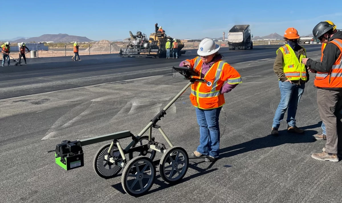
Push Cart
The push cart system provides both quick spot checks as well as continuous maps of compaction and temperature.
Vehicle Mounted
The vehicle mount can carry 1-3 scan heads and attaches to a two-inch trailer hitch. Quickly generate maps of compaction, temperature, and roughness.
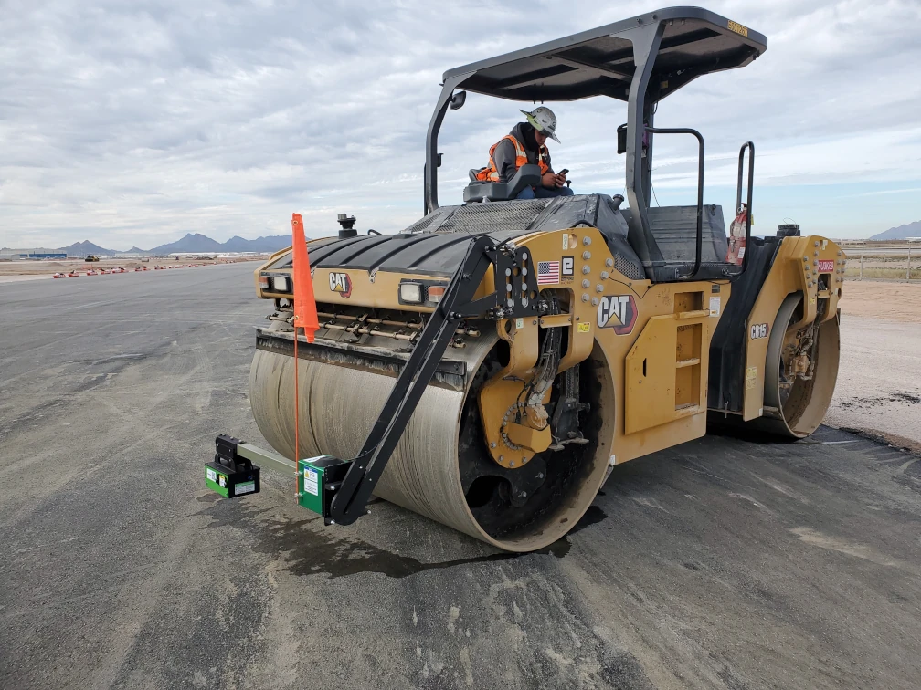
Roller Mount
The roller mounted system attaches to most roller compactors using a roller-specific adapter plate. Provides and real-time feedback to roller operator. Display shows maps of compaction, temperature, and pass-count.
Calibration Kit (optional)
Measure dielectric constant of gyratory compactor pucks to obtain precise density/compaction calibration for each asphalt mix design.
Advanced Reporting Software
Create maps of dielectric, compaction, density, temperature, and roughness. Create PDF reports and map overlays on Google Maps satellite imagery. Export data to industry standard VETA software. Generate histograms and pass/fail statistics.
Cloud Data Sharing
Share maps of compaction, temperature, and pass count with team members in the field and office. Provides interactive maps to team members on their mobile devices.
Internal GPS
The high-accuracy internal GPS assures precise mapping.
Easy Setup with No Cables
No cables to get frayed, and no damaged or dirty connectors to replace. Eliminates intermittent connections. Fast disassembly for easy storage and shipping.
No Nuclear Sources
The Asphalt Pavement Scanner eliminates the costs and risks associated with nuclear sources. No more nuclear safety training classes. No more source licensing headaches.
